Periskal Viewer including Routeplanner
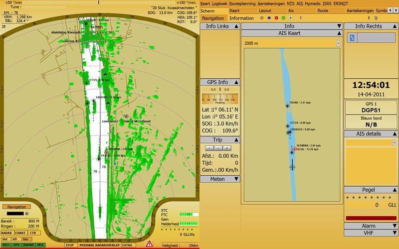
The Periskal Inland ECDIS Viewer is the standard software for navigation in inland shipping. The program is connected with a GPS and/or an AIS transponder and shows continuously the position of the vessel on the screen. Everything you need for navigation is on the chart. It contains all information like VHF channels, radar information, radio reporting points, place names, distance marks, bridge clearance, harbour numbers, pictures of bridges etc. In a separate window the VHF channels and river kilometers are shown. When put in the neighbourhood of the radar the Periskal Inland ECDIS Viewer helps distinguishing ships and buoys. Navigation in ‘North Up’, ‘Course Up’ and ‘Radar’ mode is possible.
The software is built conform the regulations of Inland ECDIS, a standard approved by the EU, CCNR and Danube Commission. It follows all rules set out by the EU RIS Directive. All charts are in the S-57 v2.3/v2.4 format. The product is meeting the requirements for the mandatory electronic chart system on the River Rhine as defined by the Rhine Commission and the German Authorities.
Official charts from European River Authorities and Periskal private data can be used. Actual water levels can be shown via manual input of ‘pegels’ or automatic input via Mobile Data. (4G)
Periskal products are used in inland shipping, on salvage vessels, passenger vessels, fishing boats, ferries, dredging vessels, cranes, seagoing vessels, airplanes, police and customs vessels, by fire brigade, on harbour patrol vessels etc. Nowadays more than 6000 vessels in Europe navigate with Periskal software and charts.
As a user of navigation software you know the phenomenon that the course of your ship isn’t always accurate. The problem is inherent to GPS and poses at the ‘lying still’ and ‘quick’ turning around of the ship. One can solve the problem with a – very expensive – gyro compass or an expensive GPS compass.
Properties
- Standard product for inland navigation
- Compliant with (Inland) ECDIS standard 2.3/2.4 and RIS (River Information Services)
- Open street Map background possible
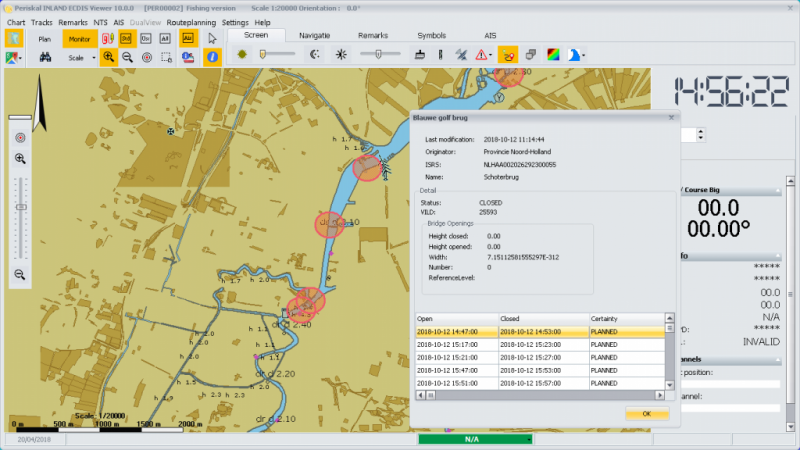
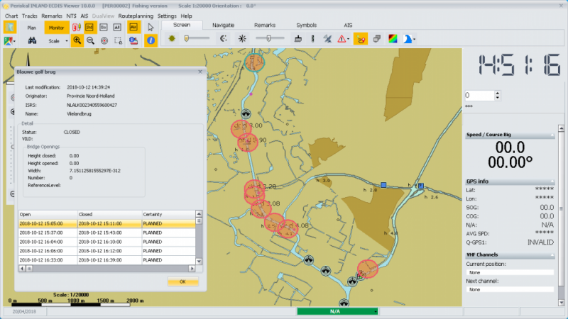
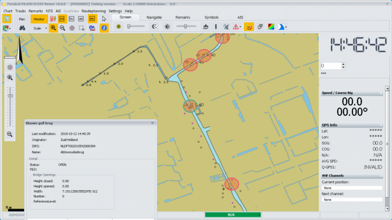
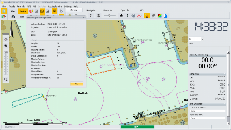
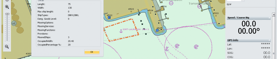
- Connection with the "Blue Wave" Service for actual bridge opening times in Holland
- Input of DGPS
- Showing charts in different scales
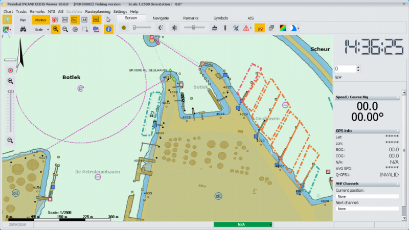
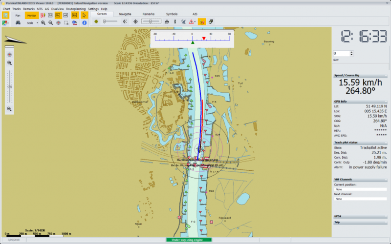
- Showing ships position on chart
- Ship on scale
- Automatic scroll of charts
- Day, dusk and night view can be regulated in several steps
- Extended Trackfunction and event registration, automatic logbook
- Routeplanning by waypoints or start/destination
- Measuring of distances
- Possibility to make notes on charts, printing of charts with tracks and notes
- Can receive Notice To Skipper Information, Bleu wave with information about berths, bridges and locks, Hydro-Meteo Information including water levels, chart updates etc. via RIS (River Information Services) internet server
- Showing Radar and Time contours around ship
- Multi language software (Dutch, English, French, German, Russian, Hungarian, Polish, Serbian, Croatian, Slowakian and Bulgarian language)
- Integrated Electronic Reporting Module as part of the routeplanning
- AIS option including operation as MKD (minimum keyboard display) for black box AIS PM
- Option Collision warning
- Option Course prediction
- Option Argonics Pilot module to operate Argonics Track Pilot