Traffic monitoring
Shore based application for Traffic Monitoring
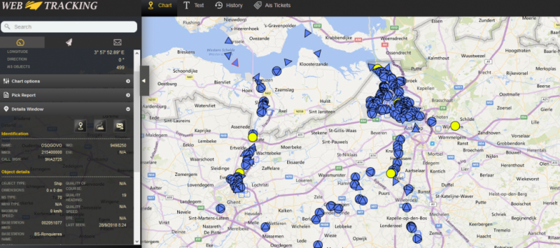
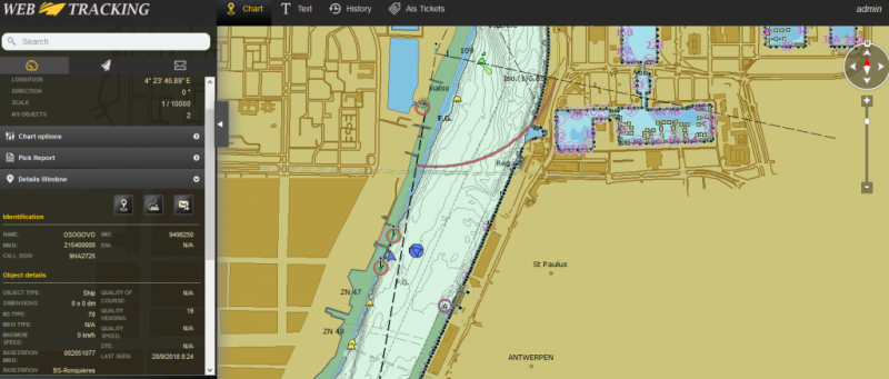
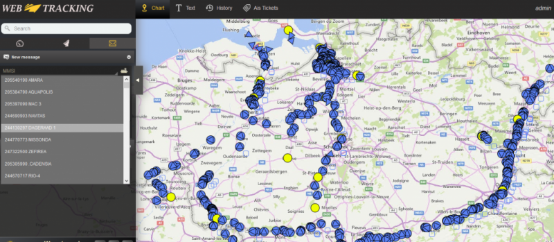
Thanks to the Tracking & tracing Web Based application developed by Periskal, you are able to provide a secure solution to display your AIS data from any computer, tablet or smapthone with an Internet connection. The User Rights Management System guarantees the privacy of your AIS data: users can only see the vessels they are allowed to. This restriction can be done geographically or by vessel(s).
Key functionalities :
- Use of Inland ENCs (Inland ECDIS v2.3/2.4
- Use of Open Streetmap as background
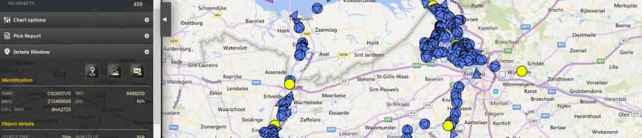
- Interrogation of Inland ENC's possible, so called Pick Report
- Possibility to zoom In/Out and move Left/Right and Rotate
- Advanced AIS Label configuration
- Easy Print and export functions for image and video captures
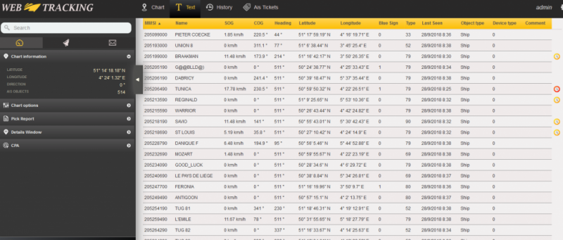
- Chart Viewe, Table View
- Management of AIS Messages, Incoming/Outgoing
- Creation of Alarm Zones
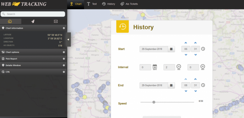
- Replay of AIS History Data
- Route Planning
- Virtual Buoys (Aton) creation, management
- Advanced Search Mode on ship name/MMSI/destination etc...
- Alarm Zones creation and monitoring
- CPA and TCPA calculation
- Anchor Alarm
- Information panel for Officer of the Watch
- Sending of AIS Hydro Meteo messages
- Time Line view on Rivers and Canals
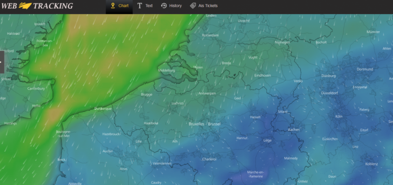
- Weather Overlay with wind/rain/temperature etc.. realtime and forecast
This Web Based application can be used as the main solution to display AIS data on normal PC's, tablets and smartphones (Android and IoS).
Key Features
- Flexible: only an Internet connection is needed
- Custom-Made: you can choose exactly what features you want depending on your needs
- Evolving: you can add later different modules
- No Plug-ins needed
- HTML-5 technology
XML Web service
The same properties as described in the previous section are available through an XML webservice that offers the possibility to retrieve specific information without any human interaction such as:
- Actual Ship Positions
- Ship Departure/Arrival Notifications
- ETA calculations
- Exchange of data with other networks on regular basis
Web based monitoring of Hydro and Meteo information
Along the waterway the waterlevel can be monitored with a variaty of sensors like radar level montioring or pressure sensor monitoring. This information of the current and historical level can be displayed in a web based environment with Inland ECDIS charts and/or Open Streetmap chart as background. In one view the actual levels are visible. Warning and alarm levels can be set.
Meteo sensors along the waterway can measure wind, rain, visibility, temperature etc.. All this information cen be stored in a central application.
Key features :
- HTML 5 based technology
- Useable on PC, smartphone (Android and IoS) and tablet
- Background map Inland ECDIS and/or Open Street Map
- Real time view
- History View
- user friendly
- Similar look and feel as Tracking and Tracing Application
- Zoom in/out, panning, rotate functionality